Standards & municipalities
What the zoning plan permits: the building plot explained
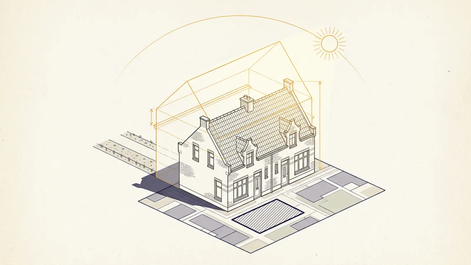
A Dutch municipality’s omgevingsplan records a building plot per parcel with a maximum eaves and building height: the planning-permitted volume. Every Dutch address has one, but only newer plans publish it as data. What it leaves out: permit-free building, in-plan deviation powers and custom rules.
What is the planning-permitted volume?
The planning-permitted volume is the building volume that the municipality's omgevingsplan allows on a parcel: the building plot on the plan map, combined with the maximum eaves height and building height stated in the annotation beside it. Schaduwplan calls that volume the envelope. It is a planning ceiling, not a permit and not a building drawing.
Three terms make up that envelope. The building plot (bouwvlak) is the area of the parcel within which the main building may stand; outside it a different and usually stricter regime applies. The eaves height (goothoogte) is the height up to the top of the wall, where the roof begins. The building height (bouwhoogte) is the highest point of the structure. Two buildings with the same building height but a different eaves height cast a noticeably different shadow at a low sun angle, which is exactly why the plan records both values separately.
The envelope therefore describes the maximum room, not the house that stands there. Someone watching a neighbour build is looking at a concrete plan; someone reading the omgevingsplan is seeing what could have been built there at the outside. That difference is why the comparison so often matters in a formal view or an objection.
Why it comes from the omgevingsplan and not from the Kadaster
The permitted volume comes from the municipality's omgevingsplan. Not from the Kadaster, and that is not a detail. The Kadaster registers who owns which parcel and where the boundaries run. What you may build on that parcel is a decision of the municipal council, not a fact about ownership.
Under article 2.4 of the Omgevingswet, the municipal council adopts one omgevingsplan for the entire territory of the municipality. That plan is the successor to the old zoning plans (bestemmingsplannen). According to the Informatiepunt Leefomgeving, during the transition the omgevingsplan consists of two parts: a temporary part, into which the old zoning plans and the state's so-called bruidsschat were transferred automatically, and a new part that the municipality builds up step by step. Municipalities have until 1 January 2032 to finish that conversion.
For a sunlight study that means two things. First, the source of the permitted volume sits with the municipality rather than with a national key register, so its form and quality differ per municipality. Second, an address may fall under the temporary part, with a zoning plan from, say, 2011 as the applicable law. Both are normal, and both are equally binding.
Every address has one, not every address publishes it as data
Every Dutch address falls under an omgevingsplan and therefore has a permitted volume. What differs is the form in which the municipality publishes it. Since the digitisation standards for spatial plans came into being, newer plans record the building plot as a machine-readable object with an annotation for the maximum eaves and building height. Older plans consist of a scanned map with separate written rules.
Schaduwplan queries the national Ruimtelijke Plannen register of Informatiehuis Ruimte for every address. If that returns a building plot, the objects panel announces that a permitted volume exists. If it returns nothing, that announcement stays away. That says nothing about what may be built at that address: the plan applies in full, it is simply not online as data. Reading that empty result as a prohibition reads it wrongly.
The distinction is sharper than it sounds, because the consequences differ:
| Result | What it means | What you do |
|---|---|---|
| Building plot with dimensions found | The plan publishes the plot and both heights as data | Review the values, confirm or correct them |
| Plot found, heights only in the rules | The plot is an object in the plan, the dimensions sit in the article text | The plot is taken over (cut off at your parcel), you enter the heights |
| No building plot found | The plan is not published as data. An omgevingsplan does apply | Consult the plan map through Regels op de kaart |
| Register unreachable | The connection is not working at that moment | Try again later or draw the volume yourself |
What the building plot does not describe
The building plot with its eaves and building height is not the complete permitted volume. Three categories fall outside it by default, and all three can allow more in practice than the plan map shows.
The first is permit-free building. The Besluit bouwwerken leefomgeving and the bruidsschat allow a range of structures without a permit for the building activity, including ancillary buildings in the rear garden area. Those are not in the building plot, but they do cast shadow. The second is the in-plan deviation power: many plans give the municipal executive room to depart from their own rules within limits, for example by an extra metre of building height. The third is the custom rule or custom requirement (maatwerkregel, maatwerkvoorschrift), with which the municipality can decide something different case by case.
On top of that, the planning rules themselves need interpretation. A building plot says nothing about which regime applies inside it, which annotation belongs to which article, or which exceptions to the dimensions apply. Schaduwplan deliberately does not derive that reading. We compute and document; the legal interpretation of the building rules stays with you and your architect.
One more warning, and it is not ours but the source operator's. The OpenAPI specification of the Ruimtelijke Plannen API states that until the Omgevingswet enters into force the user must take into account that oefencontent may be present in the data store, and it recommends carrying that warning into any application built on the API. Oefencontent is practice material that looks like a real plan. So always check the annotation on the plan map before you confirm a value.
What to do when your plan is not published as data
If the register returns nothing, the manual route to the same answer is short. Open Regels op de kaart at the Omgevingsloket, search for your address and click the parcel. You get the rules that apply at that point, with the documents they sit in. For plans from before the Omgevingswet, the original zoning plan is often still archived at ruimtelijkeplannen.nl.
On the map, find the area your parcel falls in and the annotation with the maximum eaves and building height. Then read the article in the planning rules that belongs to that designation: it states how the dimensions are to be applied. If the reading is unclear, ask the municipality or your architect. A misread article is the kind of mistake that only surfaces at the permit application.
With those two numbers and the outline of the area you can draw the volume in Schaduwplan yourself. The report then states, per value, that you entered it rather than that it came from the register. That is not weaker substantiation, but it is different substantiation: a reader of the report sees immediately where each figure came from.
How Schaduwplan uses the permitted volume
Schaduwplan consults the omgevingsplan automatically as soon as you enter an address. If detection finds a building plot, a bar appears above the objects panel and a Permitted situation section below it. Opening it shows the building plot, the eaves and building height that were found, the plan ID and the retrieval date. Automatic detection emphatically does not mean automatic insertion: nothing enters the scene until you have confirmed or corrected every value.
Correct a height and the label beside that field flips from From plan to Adjusted straight away, and you can note in one line why. That note appears in the report next to both values. An official reading the report can therefore see, per figure, whether it came from the plan, was corrected by you, or was entered by you.
In the report the permitted volume sits beside the existing and the requested situation. The pass or fail verdict stays defined on the comparison between existing and requested; that is what the sunlight standards are about. The Council of State called the TNO standards not unusual in its Almelo ruling of 18 January 2023 (ECLI:NL:RVS:2023:172), and that test remains the core of the report. The permitted volume is the third column beside it: usable as evidence in a formal view or objection, but not itself a test against a standard.
The underlying geometry comes from the same open sources as the rest of the report: 3DBAG for the existing buildings, BAG for the building identification, AHN for the ground surface. The permitted volume is an extra layer on top of that, with its own provenance note per value.
Sources (11)
We back every article with public sources. Click to see all the original documents, rulings and datasets.
Sources (11)
We back every article with public sources. Click to see all the original documents, rulings and datasets.
Legislation
- Omgevingswet, article 2.4 — one omgevingsplan per municipality— wetten.overheid.nl
- Besluit bouwwerken leefomgeving (Bbl) — permit-free building activities— wetten.overheid.nl
Registers and viewers
- Regels op de kaart — consult the omgevingsplan per parcel— Omgevingsloket, Ministry of the Interior
- Ruimtelijkeplannen.nl — the archive of Dutch zoning plans— Informatiehuis Ruimte
- API register of the Digitaal Stelsel Omgevingswet— Ministry of the Interior
Guidance on the omgevingsplan
- The omgevingsplan — instruments under the Omgevingswet— Informatiepunt Leefomgeving (IPLO)
- The temporary part of the omgevingsplan and the bruidsschat— Informatiepunt Leefomgeving (IPLO)
Case law
- Council of State 3 July 2013 — Ootmarsum: zoning plan annulled for a missing sunlight study— ECLI:NL:RVS:2013:191
- Council of State 18 January 2023 — Almelo: TNO standards are not unusual— ECLI:NL:RVS:2023:172
Data sources
- 3DBAG — 3D models of every Dutch building— TU Delft 3D Geoinformation and 3DGI
- BAG — Key Register of Addresses and Buildings— Kadaster
Frequently asked questions
- Does the permitted volume come from the Kadaster?
- No. The Kadaster registers ownership and parcel boundaries, not what you may build on a parcel. The permitted volume comes from the municipality’s omgevingsplan: the building plot on the plan map plus the annotation stating the maximum eaves and building height. Schaduwplan retrieves those from the national Ruimtelijke Plannen register, maintained by Informatiehuis Ruimte. The cadastral parcel boundary does play a supporting role: where the building plot runs beyond your parcel, Schaduwplan cuts the prefilled plot off at that boundary. The boundary is indicative and not surveyed, the report labels the cut as such, and you can switch it off in the dialog.
- No building plot was found at my address. What does that mean?
- It means the plan at that address is not published as data. Every Dutch address falls under an omgevingsplan; only the form in which the municipality publishes that plan differs. With older plans the building plot exists as a drawing on a scanned plan map rather than as a machine-readable object. An empty result therefore says something about how the plan was digitised, not about what may be built at that address.
- Is the building plot the same as everything I am allowed to build?
- No, it is the floor of the story rather than the ceiling. Permit-free building under the Besluit bouwwerken leefomgeving and the bruidsschat is not in it, in-plan deviation powers are not in it, and custom rules (maatwerkregels) are not in it either. In practice more is often allowed than the plan map shows. Have your architect read the planning rules before drawing conclusions.
- Can I use the permitted volume to show that my plan meets the sunlight standard?
- The standards test stays the comparison between the existing and the requested situation. The permitted volume is context beside it: it shows how much shadow was allowed to arise there in any case. That is usable as evidence in a formal view or objection, but it is not a pass or fail verdict of its own.
- What is oefencontent and why does Schaduwplan warn about it?
- The OpenAPI specification of the Ruimtelijke Plannen API warns that until the Omgevingswet enters into force the data store may contain oefencontent: practice plans that look like real ones. That warning comes from the operator itself, and the specification recommends carrying it into any application built on the API. So always check the annotation on the plan map before you confirm a value.
- What if the eaves and building height are only stated in the planning rules?
- That happens regularly. Some plans record only the building plot as an object and name the maximum heights in the article text. Schaduwplan then takes the building plot over, cut off at the cadastral parcel boundary of the address, and leaves the two height fields empty for you to fill in from the planning rules. The report states, per value, whether it came from the plan or from you.
See what the plan permits beside what is being built
Enter an address. Schaduwplan checks for itself whether the omgevingsplan publishes a building plot with its dimensions there, and puts the permitted volume beside the existing and the requested situation in one report.
Read more
Standards & municipalities
Sunlight and Dutch neighbour law: which rules apply
Three separate frameworks govern sunlight at a home. Sunlight access (the TNO standard) is a guideline, not a law. Daylight (Articles 4.146 and 4.147 of the Building Works Environment Decree) is the only one written into national law. Neighbour law (Article 5:37 of the Civil Code) governs unlawful nuisance. Window size counts for daylight, not for sunlight access.
Standards & municipalities
What does a sunlight study cost in 2026? A price comparison
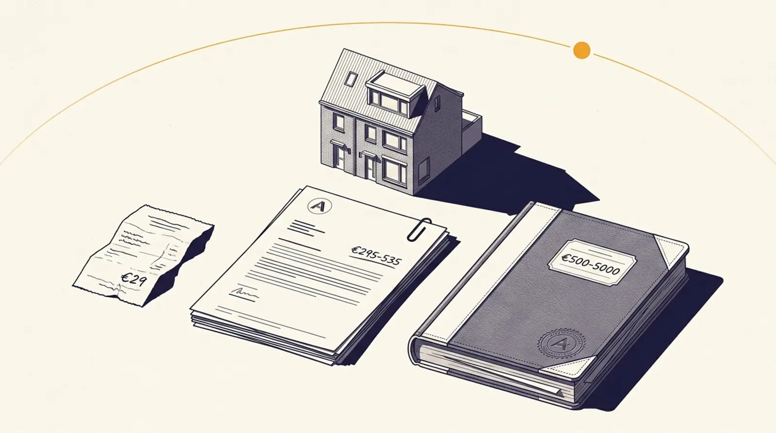
A sunlight study in the Netherlands ranges from € 39 for an automated self-service report to € 5,000 for a large engineering firm with a sworn expert. This guide sets four price tiers side by side — self-service tools, an independent building-advice consultant, a small firm and a large engineering firm — with honest trade-offs in turnaround, legal weight and iteration.
Standards & municipalities
The TNO sunlight standard: light and strict variants
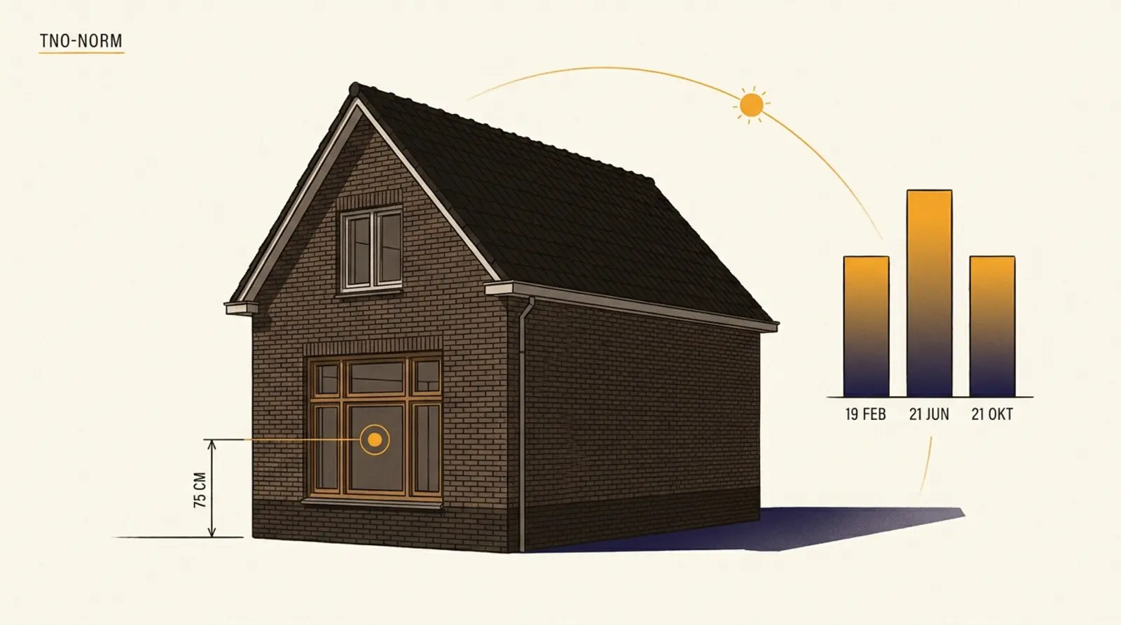
The TNO sunlight standard defines how many sun hours a home must receive on set test dates. The light standard requires 2 sun hours from 19 February to 21 October; the strict standard 3 sun hours from 21 January to 22 November. The Hague, Rotterdam, Eindhoven and Krimpen use their own variants. This is the de facto standard in Dutch permit decisions.